Useful information
Prime News delivers timely, accurate news and insights on global events, politics, business, and technology
Useful information
Prime News delivers timely, accurate news and insights on global events, politics, business, and technology
All about news around the world and you will know everything
All about news around the world and you will know everything
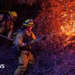
A devastating combination of fires, fierce Santa Ana winds and drought have turned parts of the Los Angeles metropolitan area into a disaster zone. Multiple major wildfires are causing mass evacuations and consuming homes and buildings. As flames burn on the ground, eyes in space follow the movements of fires across Los Angeles County.
Read more: Los Angeles Fires: Donations, Relief Efforts, and How to Help Fire Victims
The figures are almost unfathomable. The California Department of Forestry and Fire Protection, known as Cal Fire, is tracking the flames. As of Thursday morning, the Palisades Fire had consumed more than 17,000 acres and was at zero percent containment. The next largest is the Eaton Fire, at 10,600 acres and also with zero percent containment. Other smaller fires are also active, including the Sunset Fire in the Hollywood Hills, near landmarks such as the Hollywood Sign and the Hollywood Walk of Fame. The cause of the wildfires is under investigation.
Expand image
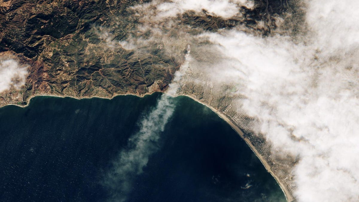
NASA’s Earth Observatory, a public outreach effort, shared Satellite images showing smoke and its spread from above, with a focus on the Palisades Fire, which broke out on January 7. An initial image from the European Space Agency’s Sentinel-2 Earth observation satellite showed the first plume of smoke from the fire on the morning of January 7. Even at that time, it was generating an enormous amount of smoke as it grew rapidly.
Expand image
NASA’s Aqua satellite captured a view later on January 7. The image emphasizes the spread of the fire and the extension of the smoke column towards the Pacific Ocean.
“Although windy conditions are typical for this time of year, the lack of rain contributed to the dangerous fire weather,” NASA said.
Other satellites are also watching. The NASA-built GOES-West satellite is operated by the National Oceanic and Atmospheric Administration. NOAA makes current images available to the public. The satellite view of the The Pacific Southwest covers Los Angeles. The satellite captured the wide plumes of smoke from the Jan. 9 fires.
Expand image
The fires are affecting NASA. The agency’s Jet Propulsion Laboratory, the base for many of NASA’s major space exploration missions, is in the mandatory evacuation zone for the Eaton Fire. JPL plans to remain closed until Monday. “Currently, JPL facilities, laboratories and hardware are secured and protected.” the organization said in a Jan. 8 update.
Firefighters have a long battle ahead of them. Continued high winds and dry conditions make fires difficult to contain. Los Angeles County residents can check Cal Fire and the Watch Duty app for updates.
Here are ways to help those affected by the fires. Satellites will continue to monitor the situation from above.


[…] Eaton Fire […]